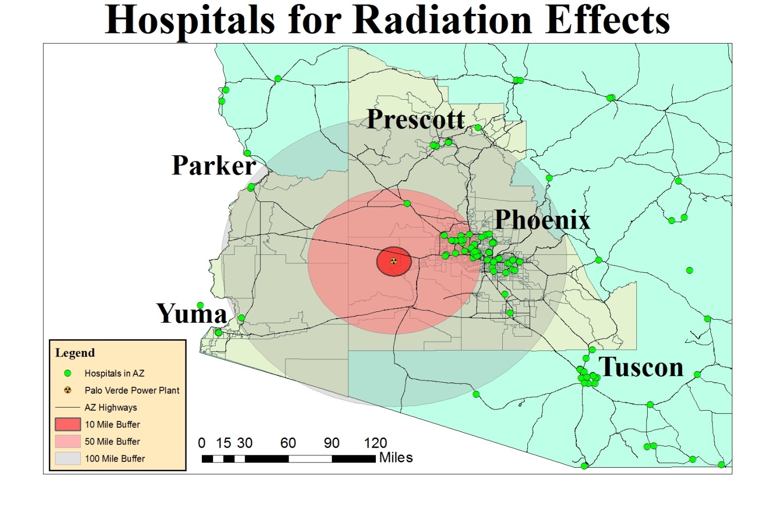
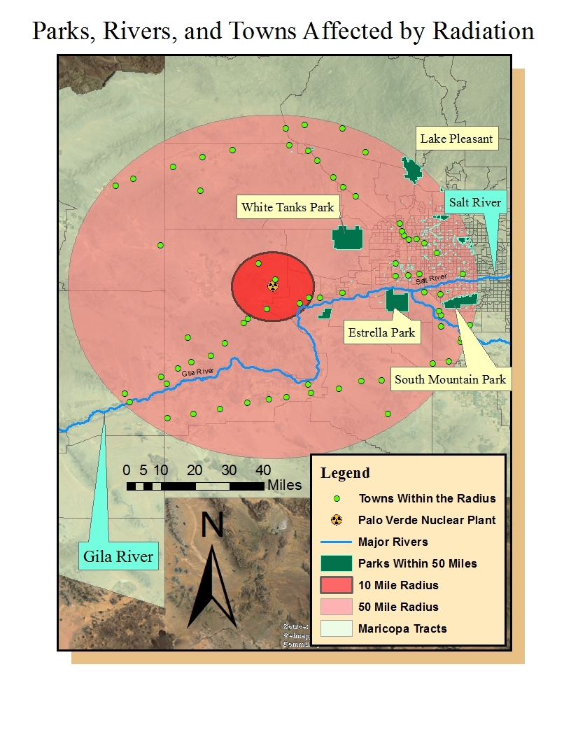
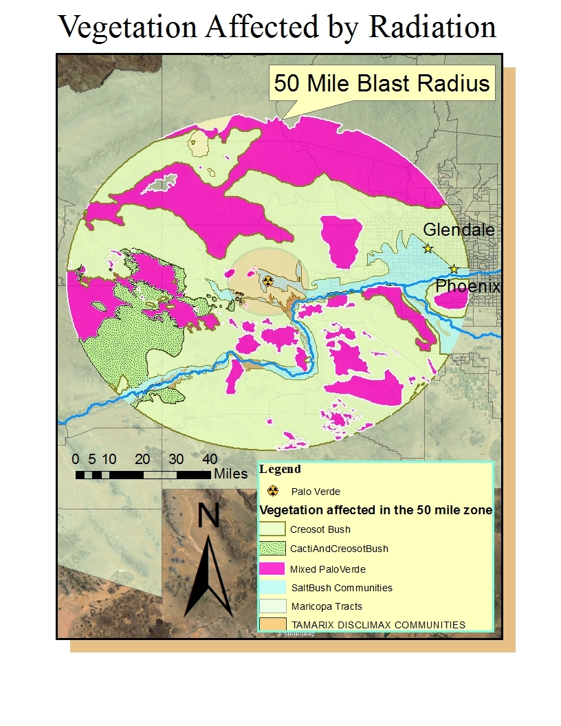
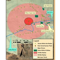
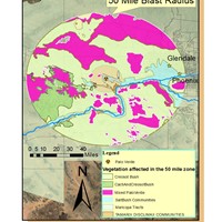
Through use of GIS, i made a model of what would happen in the nuclear meltdown. This location is in western Maricopa and is the Palo Verde power plant. The three maps indicate hospitals to evacuate to, the parks-rivers-and towns that are affected, and the natural vegetation that would be affected from the 10 and 50 mile blast.